The Great Smoky Mountains Finale
The end has come at last. Actually it came awhile ago, I've just been very slow to update the blog... call it a food coma since I've done nothing but eat since I came off the trail.
About a week into the latest section I finally injured myself. I say "finally" because really I expected it much sooner. I'm not exactly the most graceful person. So, though it was still unfortunate, it came as no real surprise that I sprained an ankle before reaching my ultimate goal of Springer Mountain in Georgia.
I'm fine, it was a minor sprain, but hiking all day long gives no time for resting or healing, so I was faced with the decision to leave the trail for good, or hole up in a town for a few days and then continue. Ultimately I chose to come off the trail as delaying several days would push my schedule up against other commitments.
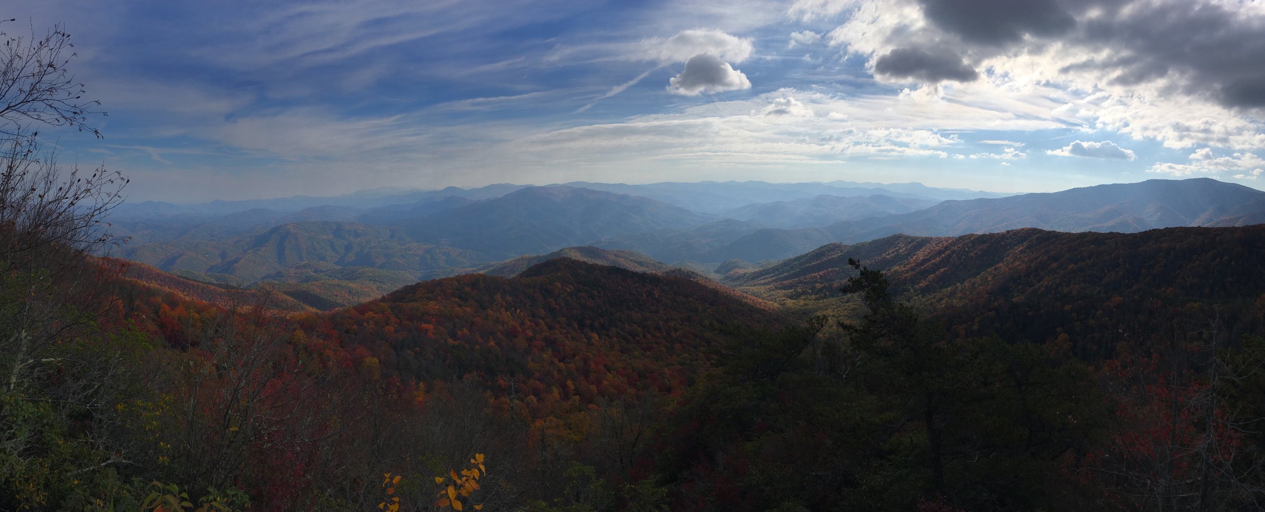
Even so, I was thrilled to be able to cover almost the entire Great Smoky Mountains National Park, which is beautiful at any time of year, but was simply stunning with the changing fall leaves.

I spent a lot of the hike just looking up and watching the light come through the leaves...
No comment on how exactly I sprained my ankle.

The trail into the Great Smoky Mountains more or less climbs straight up when you hit the edge of the park and you then spend the next several days hiking ridge lines. When I say straight up, I mean that I gained over 4000 feet on the first day alone. After that initial uphill push the following days felt exhaustingly like old n64 cheats (up+down+up+up+L+down+R+up+down+up) with desperate breaks in the middle where I pondered A) whether it was possible for my legs to simply fall off, and B) whose stupid idea this was anyway.
But although the ridge line hiking meant lots of winded stops and rocky terrain, it also meant really amazing views around pretty much every corner. Since words can't really describe them here is a photo dump:


The shortened days as winter drew nearer meant I was usually up and hiking before the sun in order to cover decent mileage. It was cold but also beautiful watching the sun rise through the trees.


The highest point in the park is Clingmans Dome at 6643 ft, which is also the highest point on the entire Appalachian Trail (and the state of TN). The view from the top was fairly obscured by the mist, but they're not called the Great Clear View Mountains.
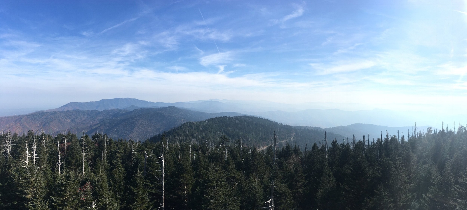
Clingmans Dome


Other than the beautiful views I've also learned that I'm what's known in AT terms as a "lasher." I had the following conversation at one of my shelter stops.
A fellow hiker asked one of the most common questions on the trail: "Are you a thru?" To which I've always responded, "Nah, just a section hiking chump." He followed by asking how long I'd been at it and I told him I was at about 400 miles now, and he laughed and said, "Oh you're not a section hiker then, you're a lasher."
And I said, "A what?"
"A LASHer. A Long-Ass-Section-Hiker."
I don't know why this term makes me happy but it does. Maybe because it feels like I'm in the cool kids club now. The AT has nicknames for various types of hikers (NOBO- northbound, SOBO- southbound, Flip Flop- hiking half the trail in one direction and then the other half in the other) but these all refer to thru-hikers. I hadn't heard of a nickname for non-thru-hikers yet. I've finally made it. I'm a hiker worthy of the lingo.

Cool as a cucumber.
That's all for now! I'll probably try and do one last post collecting some of my favorite images and a rundown of the total ground I covered. Thanks for tuning in!